
Mapa topográfico Fansipan Mountain
Mapa interactivo
Haga clic en el mapa para ver la altitud.
Fansipan Mountain
Fansipan is the tallest mountain in the Hoang Lien Son Range, situated on the border of Lào Cai Province and Lai Châu Province with its peak located on the Lào Cai side. The mountain is part of the Hoàng Liên National Park. It has a topographic prominence of 1,613 metres (5,292 ft), ranking 6th in Vietnam.
Acerca de este mapa
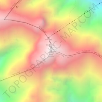
Nombre: Mapa topográfico Fansipan Mountain, altitud, relieve.
Altitud media: 2.616 m
Altitud mínima: 1.822 m
Altitud máxima: 3.099 m