
Gracias por apoyar a este sitio ❤️
Haz una donación
Haz una donación
Mapa topográfico Savannah
Haga clic en el mapa para ver la altitud.
Gracias por apoyar a este sitio ❤️
Haz una donación
Haz una donación
Savannah
Savannah es propensa a las inundaciones debido a las abundantes lluvias, una elevación justo por encima del nivel del mar y la forma de la costa, que presenta un mayor riesgo de marejadas durante los huracanes. La ciudad utiliza actualmente cinco canales. Además, se han construido varias estaciones de bombeo para ayudar a reducir los efectos de las inundaciones repentinas.
Gracias por apoyar a este sitio ❤️
Haz una donación
Haz una donación
Acerca de este mapa
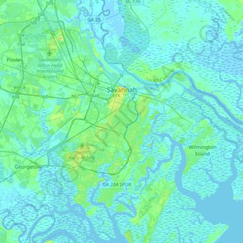
Nombre: Mapa topográfico Savannah, altitud, relieve.
Lugar: Savannah, Chatham County, Georgia, Estados Unidos de América (31.88785 -81.37143 32.18966 -81.02952)
Altitud media: 4 m
Altitud mínima: -5 m
Altitud máxima: 33 m
Gracias por apoyar a este sitio ❤️
Haz una donación
Haz una donación