
Mapa topográfico El Torno
Mapa interactivo
Haga clic en el mapa para ver la altitud.
Acerca de este mapa
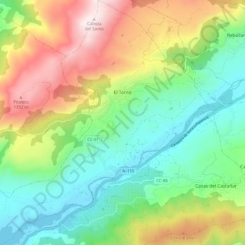
Nombre: Mapa topográfico El Torno, altitud, relieve.
Lugar: El Torno, Valle del Jerte, Cáceres, Extremadura, Spain (40.08895 -6.00005 40.16455 -5.91007)
Altitud media: 769 m
Altitud mínima: 361 m
Altitud máxima: 1.479 m
El Torno is a small village at the west of Spain. It is a mountains village, and has a river named Jerte. The village is at 900 m altitude. The main monument is an old church. It is an agriculture village, and its main fruit is the cherry. It is rainy and has much forest. The more important holiday is San Lucas on October 18, and also the Carnival is very important.[citation needed]