
Mapa topográfico Katwa
Mapa interactivo
Haga clic en el mapa para ver la altitud.
Acerca de este mapa
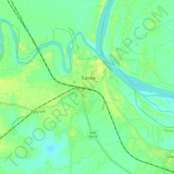
Nombre: Mapa topográfico Katwa, altitud, relieve.
Lugar: Katwa, Katwa - I, Purba Bardhaman, West Bengal, 713130, India (23.59993 88.08802 23.67993 88.16802)
Altitud media: 16 m
Altitud mínima: 9 m
Altitud máxima: 24 m
Katwa is located at 23°39′N 88°08′E / 23.65°N 88.13°E / 23.65; 88.13. It has an average elevation of 21 m (69 ft). It is situated between the Ajay River and the Hooghly River and so bounded by water to the east, west and north.