
Mapa topográfico Marshall
Mapa interactivo
Haga clic en el mapa para ver la altitud.
Acerca de este mapa
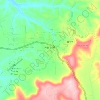
Nombre: Mapa topográfico Marshall, altitud, relieve.
Lugar: Marshall, Searcy County, Arkansas, 72650, United States (35.89277 -92.67378 35.92193 -92.60221)
Altitud media: 331 m
Altitud mínima: 226 m
Altitud máxima: 503 m
For bicycling, the Ozark Grinder Trail is a nearby gravel grinder bicycle trail covering approximately 200 miles and 13,000 feet of elevation in north central Arkansas Ozarks. The annual Arkansaw High Country Race transits through Marshall each June. This event is an approximately 1,034-mile self-supported (bikepacking) gravel cycling race with approximately 84,000 feet of total elevation.