
Mapa topográfico Solapur
Mapa interactivo
Haga clic en el mapa para ver la altitud.
Solapur
Solapur is located at 17°41′N 75°55′E / 17.68°N 75.92°E / 17.68; 75.92. It has an average elevation of 458 metres (1502 feet). It is bordered by Ahmednagar district on the north; Osmanabad district on the north and northeast.
Acerca de este mapa
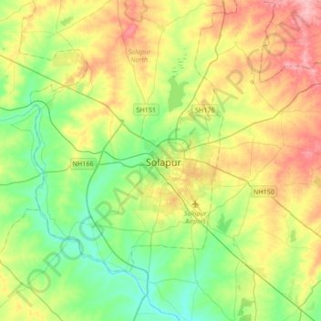
Nombre: Mapa topográfico Solapur, altitud, relieve.
Altitud media: 469 m
Altitud mínima: 424 m
Altitud máxima: 541 m