
Mapa topográfico Villahermosa
Mapa interactivo
Haga clic en el mapa para ver la altitud.
Acerca de este mapa
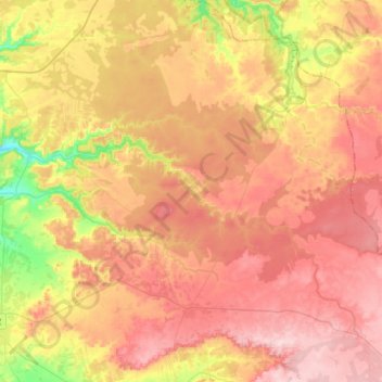
Nombre: Mapa topográfico Villahermosa, altitud, relieve.
Altitud media: 924 m
Altitud mínima: 798 m
Altitud máxima: 1.017 m
Villahermosa is located in the southeast of Mexico between the rivers Grijalva and Carrizal. The average elevation of the city is 10 meters above sea level. The city also has several lagoons, the largest and most important of them being La Laguna de las Ilusiones (Illusions Lagoon).