
Mapa topográfico Bridgeville
Mapa interactivo
Haga clic en el mapa para ver la altitud.
Bridgeville
According to the United States Census Bureau, the borough has a total area of 1.1 square miles (2.8 km2), all of it land. Its average elevation is 1,250 ft (381 m) above sea level.
Acerca de este mapa
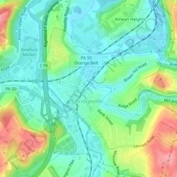
Nombre: Mapa topográfico Bridgeville, altitud, relieve.
Altitud media: 275 m
Altitud mínima: 242 m
Altitud máxima: 344 m