
Mapa topográfico Ponchatoula
Mapa interactivo
Haga clic en el mapa para ver la altitud.
Acerca de este mapa
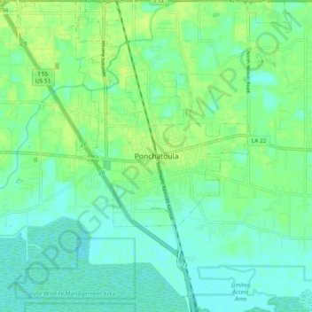
Nombre: Mapa topográfico Ponchatoula, altitud, relieve.
Altitud media: 7 m
Altitud mínima: 1 m
Altitud máxima: 14 m
Ponchatoula is located at 30°26′21″N 90°26′33″W / 30.43917°N 90.44250°W / 30.43917; -90.44250 (30.439162, -90.442507) and has an elevation of 26 feet (7.9 m). According to the United States Census Bureau, the city has a total area of 4.2 square miles (11 km2), all land.