
Gracias por apoyar a este sitio ❤️
Haz una donación
Haz una donación
Mapa topográfico Kanyakumari
Haga clic en el mapa para ver la altitud.
Gracias por apoyar a este sitio ❤️
Haz una donación
Haz una donación
Kanyakumari
Kanniyakumari is located at 8°05′N 77°34′E / 8.08°N 77.57°E / 8.08; 77.57 and has an average elevation of 30 metres. The peninsular tip of Kanniyakumari is bordered on three sides by the Laccadive Sea. It is located at the confluence of the Western Coastal Plains and Eastern Coastal Plains. The nearest city is Thiruvananthapuram, Kerala (85 km (53 mi) away), and the nearest town is Nagercoil, the administrative headquarters of Kanniyakumari district (22 km (14 mi) away).
Gracias por apoyar a este sitio ❤️
Haz una donación
Haz una donación
Acerca de este mapa
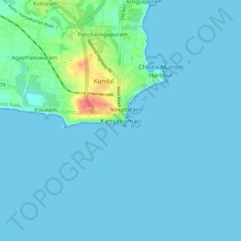
Nombre: Mapa topográfico Kanyakumari, altitud, relieve.
Altitud media: 6 m
Altitud mínima: 0 m
Altitud máxima: 55 m
Gracias por apoyar a este sitio ❤️
Haz una donación
Haz una donación