
Mapa topográfico Stavelot
Mapa interactivo
Haga clic en el mapa para ver la altitud.
Stavelot
Stavelot has an oceanic climate influenced by its high elevation and inland position towards a more continental type by Belgian standards. Being located at a lower elevation than neighbouring village Malmedy at the other end of the original layout of the Spa-Francorchamps race track, Stavelot is slightly milder, drier and sunnier than Malmedy year round.
Acerca de este mapa
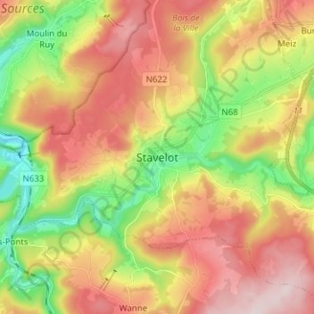
Nombre: Mapa topográfico Stavelot, altitud, relieve.
Lugar: Stavelot, Verviers, Liège, Wallonia, 4970, Belgium (50.35424 5.89103 50.43424 5.97103)
Altitud media: 401 m
Altitud mínima: 219 m
Altitud máxima: 585 m