
Gracias por apoyar a este sitio ❤️
Haz una donación
Haz una donación
Mapa topográfico Hawksbill
Haga clic en el mapa para ver la altitud.
Gracias por apoyar a este sitio ❤️
Haz una donación
Haz una donación
Hawksbill
Hawksbill Mountain is a mountain with an elevation of 4,050 feet (1,234 m). Marking the border between Madison County and Page County in Virginia, the summit of Hawksbill Mountain is the highest point in Shenandoah National Park, as well as the highest point in both Madison and Page counties.
Gracias por apoyar a este sitio ❤️
Haz una donación
Haz una donación
Acerca de este mapa
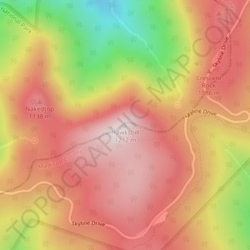
Nombre: Mapa topográfico Hawksbill, altitud, relieve.
Lugar: Hawksbill, Madison County, Virginia, United States (38.55531 -78.39519 38.55541 -78.39509)
Altitud media: 993 m
Altitud mínima: 623 m
Altitud máxima: 1.217 m
Gracias por apoyar a este sitio ❤️
Haz una donación
Haz una donación