
Gracias por apoyar a este sitio ❤️
Haz una donación
Haz una donación
Mapa topográfico Fayetteville
Haga clic en el mapa para ver la altitud.
Gracias por apoyar a este sitio ❤️
Haz una donación
Haz una donación
Fayetteville
...yet I venture the assertion that nowhere in said country—or for that matter, in any part of the state—could be found a lovelier elevation, or a lovelier grove of graceful oaks, or a more commanding view, or, in fine, a spot better suited and adapted for the purposes designated than the one chosen for said University site and farm.
Gracias por apoyar a este sitio ❤️
Haz una donación
Haz una donación
Acerca de este mapa
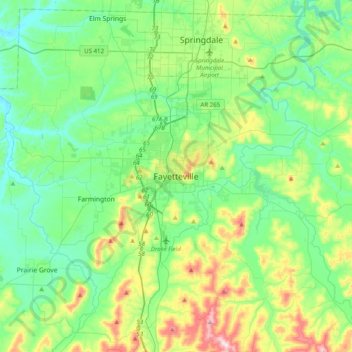
Nombre: Mapa topográfico Fayetteville, altitud, relieve.
Altitud media: 404 m
Altitud mínima: 310 m
Altitud máxima: 674 m
Gracias por apoyar a este sitio ❤️
Haz una donación
Haz una donación