
Mapa topográfico Town of Denning
Mapa interactivo
Haga clic en el mapa para ver la altitud.
Acerca de este mapa
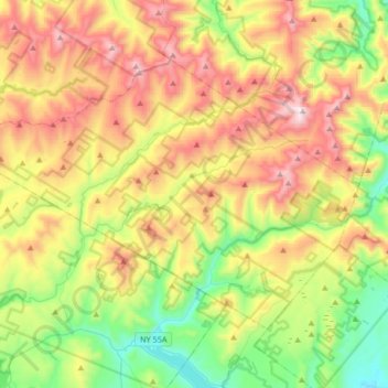
Nombre: Mapa topográfico Town of Denning, altitud, relieve.
Lugar: Town of Denning, Ulster County, New York, United States (41.85960 -74.67041 42.03198 -74.33757)
Altitud media: 663 m
Altitud mínima: 230 m
Altitud máxima: 1.260 m
The town is in the Catskill Mountains and borders Sullivan County, New York. It is rugged and heavily wooded. Most settlement is concentrated around the hamlet of Sundown on Rondout Creek, along the two branches of the Neversink River or in the plateau between the two valleys northeast of Red Hill, at elevations 2,500 feet (762 m) above sea level and higher.