
Mapa topográfico Ryhill
Mapa interactivo
Haga clic en el mapa para ver la altitud.
Acerca de este mapa
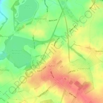
Nombre: Mapa topográfico Ryhill, altitud, relieve.
Lugar: Ryhill, Wakefield, West Yorkshire, England, United Kingdom (53.61649 -1.43262 53.63995 -1.39864)
Altitud media: 76 m
Altitud mínima: 44 m
Altitud máxima: 103 m
Otros mapas topográficos
Haga clic en un mapa para ver su topografía, su altitud y su relieve.