
Gracias por apoyar a este sitio ❤️
Haz una donación
Haz una donación
Mapa topográfico Wimborne
Haga clic en el mapa para ver la altitud.
Gracias por apoyar a este sitio ❤️
Haz una donación
Haz una donación
Wimborne
Wimborne is a hamlet in southern Alberta, Canada within Kneehill County. It is located approximately 58 km (36 mi) southeast of Red Deer. It has an elevation of 975 m (3,199 ft).
Gracias por apoyar a este sitio ❤️
Haz una donación
Haz una donación
Acerca de este mapa
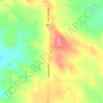
Nombre: Mapa topográfico Wimborne, altitud, relieve.
Lugar: Wimborne, Kneehill County, Alberta, Canada (51.84410 -113.61341 51.88410 -113.57341)
Altitud media: 962 m
Altitud mínima: 923 m
Altitud máxima: 1.006 m
Gracias por apoyar a este sitio ❤️
Haz una donación
Haz una donación
Otros mapas topográficos
Haga clic en un mapa para ver su topografía, su altitud y su relieve.