
Mapa topográfico Hemet
Mapa interactivo
Haga clic en el mapa para ver la altitud.
Acerca de este mapa
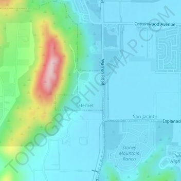
Nombre: Mapa topográfico Hemet, altitud, relieve.
Altitud media: 508 m
Altitud mínima: 455 m
Altitud máxima: 751 m
Dedicated to James Simpson, Hemet City Council 1947–48, and mayor 1950 to 1966. Simpson Park is a wilderness park located in the Santa Rosa Hills southeast of Hemet with sheltered picnic area and tables, barbecues, restrooms, and hiking trails. At an elevation of 2,500 feet (760 m), it provides an expansive view of San Jacinto Valley, as well of nearby towns of Winchester (Menifee) and Rancho California (Temecula, California), and it has an area of 438 acres (1.8 km2).