
Mapa topográfico Vaux-lez-Chêne
Mapa interactivo
Haga clic en el mapa para ver la altitud.
Acerca de este mapa
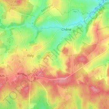
Nombre: Mapa topográfico Vaux-lez-Chêne, altitud, relieve.
Altitud media: 470 m
Altitud mínima: 415 m
Altitud máxima: 517 m
Otros mapas topográficos
Haga clic en un mapa para ver su topografía, su altitud y su relieve.
Ebly
Belgique > Luxembourg > Neufchâteau > Ebly
Ebly, Léglise, Neufchâteau, Luxembourg, Wallonie, Belgique
Altitud media: 470 m
Maisoncelle
Belgique > Luxembourg > Neufchâteau > Ebly > Maisoncelle
Maisoncelle, Ebly, Léglise, Neufchâteau, Luxembourg, Wallonie, 6642, Belgique
Altitud media: 474 m