
Mapa topográfico Hohwachter Bucht
Mapa interactivo
Haga clic en el mapa para ver la altitud.
Acerca de este mapa
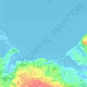
Nombre: Mapa topográfico Hohwachter Bucht, altitud, relieve.
Altitud media: 8 m
Altitud mínima: -6 m
Altitud máxima: 86 m
Otros mapas topográficos
Haga clic en un mapa para ver su topografía, su altitud y su relieve.
Farve
Deutschland > Schleswig-Holstein > Ostholstein > Wangels
Farve, Wangels, Oldenburg-Land, Ostholstein, Schleswig-Holstein, Deutschland
Altitud media: 14 m