
Mapa topográfico Cripple Creek
Mapa interactivo
Haga clic en el mapa para ver la altitud.
Cripple Creek
For many years, Cripple Creek's high valley, at an elevation of 9,494 feet (2,894 m), was considered no more important than a cattle pasture. Many prospectors avoided the area after the Mount Pisgah hoax, a mini gold rush caused by salting (adding gold to worthless rock).
Acerca de este mapa
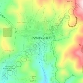
Nombre: Mapa topográfico Cripple Creek, altitud, relieve.
Lugar: Cripple Creek, Teller County, Colorado, United States (38.73050 -105.20831 38.75981 -105.16776)
Altitud media: 2.946 m
Altitud mínima: 2.796 m
Altitud máxima: 3.165 m
Otros mapas topográficos
Haga clic en un mapa para ver su topografía, su altitud y su relieve.