
Mapa topográfico Wayne County
Mapa interactivo
Haga clic en el mapa para ver la altitud.
Acerca de este mapa
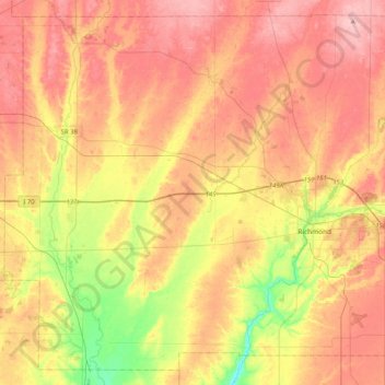
Nombre: Mapa topográfico Wayne County, altitud, relieve.
Lugar: Wayne County, Indiana, United States (39.71477 -85.22151 40.00626 -84.81071)
Altitud media: 322 m
Altitud mínima: 240 m
Altitud máxima: 385 m
According to the 2010 census, the county has a total area of 404.34 square miles (1,047.2 km2), of which 401.74 square miles (1,040.5 km2) (or 99.36%) is land and 2.60 square miles (6.7 km2) (or 0.64%) is water. Wayne County includes Indiana's highest natural elevation, Hoosier Hill, at 1,257 feet (383 m).
Otros mapas topográficos
Haga clic en un mapa para ver su topografía, su altitud y su relieve.
Richmond
United States > Indiana > Wayne County
Richmond, Wayne County, Indiana, 47374, United States
Altitud media: 314 m