
Mapa topográfico Bridgewater
Mapa interactivo
Haga clic en el mapa para ver la altitud.
Acerca de este mapa
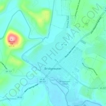
Nombre: Mapa topográfico Bridgewater, altitud, relieve.
Lugar: Bridgewater, Rockingham County, Virginia, United States (38.36928 -78.98997 38.40543 -78.94621)
Altitud media: 380 m
Altitud mínima: 351 m
Altitud máxima: 515 m
According to the United States Census Bureau, the town has a total area of 2.52 sq mi (6.5 km2), nearly all of it being land. Most of the town is located within a bend of the North River. Floods have wrecked the town occasionally. The northern areas are partly shielded from flooding with an Army Corps of Engineers dam. The wooded monadnock called Round Hill (elevation approx. 1750 feet) dominates the town's western skyline.
Otros mapas topográficos
Haga clic en un mapa para ver su topografía, su altitud y su relieve.
Dale Enterprise
United States > Virginia > Rockingham County
Dale Enterprise, Rockingham County, Virginia, United States
Altitud media: 427 m