
Gracias por apoyar a este sitio ❤️
Haz una donación
Haz una donación
Mapa topográfico Hood River
Haga clic en el mapa para ver la altitud.
Gracias por apoyar a este sitio ❤️
Haz una donación
Haz una donación
Hood River
Temperatures for the year as a whole are slightly cooler than in most other low-elevation towns in the region, especially at night because of air drainage off the surrounding mountains.
Gracias por apoyar a este sitio ❤️
Haz una donación
Haz una donación
Acerca de este mapa
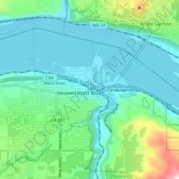
Nombre: Mapa topográfico Hood River, altitud, relieve.
Lugar: Hood River, Hood River County, Oregon, United States (45.69298 -121.56508 45.72651 -121.49538)
Altitud media: 112 m
Altitud mínima: 14 m
Altitud máxima: 504 m
Gracias por apoyar a este sitio ❤️
Haz una donación
Haz una donación