
Mapa topográfico Clovis
Mapa interactivo
Haga clic en el mapa para ver la altitud.
Clovis
Clovis is located in southeastern Curry County at 34°24′45″N 103°12′17″W / 34.41250°N 103.20472°W / 34.41250; -103.20472 (34.412509, −103.204611), 9 miles (14 km) west of the Texas border. The city's geographic center is at an elevation of 4,281 feet (1,305 m) above sea level.
Acerca de este mapa
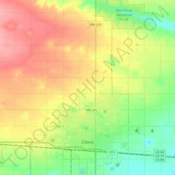
Nombre: Mapa topográfico Clovis, altitud, relieve.
Lugar: Clovis, Curry County, New Mexico, 88101, United States (34.37570 -103.26236 34.53217 -103.13462)
Altitud media: 1.317 m
Altitud mínima: 1.275 m
Altitud máxima: 1.363 m