
Gracias por apoyar a este sitio ❤️
Haz una donación
Haz una donación
Mapa topográfico Bakerville
Haga clic en el mapa para ver la altitud.
Gracias por apoyar a este sitio ❤️
Haz una donación
Haz una donación
Bakerville
Bakerville is a populated place situated within the city of Bisbee in Cochise County, Arizona, United States. It has an estimated elevation of 5,039 feet (1,536 m) above sea level.
Gracias por apoyar a este sitio ❤️
Haz una donación
Haz una donación
Acerca de este mapa
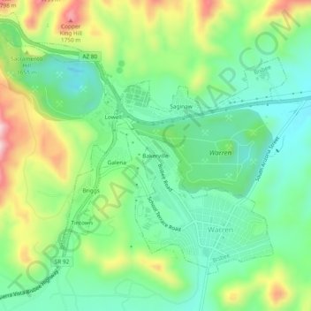
Nombre: Mapa topográfico Bakerville, altitud, relieve.
Altitud media: 1.579 m
Altitud mínima: 1.469 m
Altitud máxima: 1.790 m
Gracias por apoyar a este sitio ❤️
Haz una donación
Haz una donación