
Mapa topográfico Pensacola
Mapa interactivo
Haga clic en el mapa para ver la altitud.
Acerca de este mapa
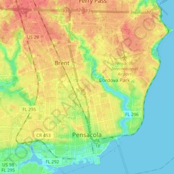
Nombre: Mapa topográfico Pensacola, altitud, relieve.
Altitud media: 21 m
Altitud mínima: -3 m
Altitud máxima: 46 m
The land is up sloping to the north from Pensacola Bay with most of the area having elevations above hurricane storm surge.