
Mapa topográfico Newland
Mapa interactivo
Haga clic en el mapa para ver la altitud.
Newland
At an elevation of 3,621 feet or 1,104 metres, it is the highest county seat in the Eastern United States (based on elevations in the USGS database).
Acerca de este mapa
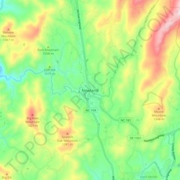
Nombre: Mapa topográfico Newland, altitud, relieve.
Lugar: Newland, Avery County, North Carolina, 28653, United States (36.04735 -81.96734 36.12735 -81.88734)
Altitud media: 1.199 m
Altitud mínima: 987 m
Altitud máxima: 1.535 m