
Mapa topográfico Chartres Cathedral
Mapa interactivo
Haga clic en el mapa para ver la altitud.
Acerca de este mapa
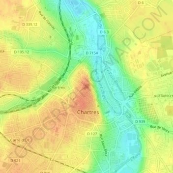
Nombre: Mapa topográfico Chartres Cathedral, altitud, relieve.
Altitud media: 148 m
Altitud mínima: 123 m
Altitud máxima: 165 m
The elevation of the nave, showing the gallery on the ground level; the narrow triforium; and, on top, the windows of the clerestory