
Haz una donación
Mapa topográfico Hot Springs National Park
Haga clic en el mapa para ver la altitud.
Haz una donación
Hot Springs National Park
The National Park Service exercises no control or supervision over any matters connected with the city. The city starts on the other side of Central Avenue from Bathhouse Row. Its development has extended beyond the narrow valley in which the springs are located, spreading out over the open plain to the south and east. The climate is good throughout the year. The elevation of the city is 600 feet (180 m) above sea level, with surrounding hills rising another 600 feet. In the first half of the 20th century, the city operated primarily as a summer resort, but hotels have now long stayed open during the winter due to many northerly patrons coming to escape the winter cold.
Haz una donación
Acerca de este mapa
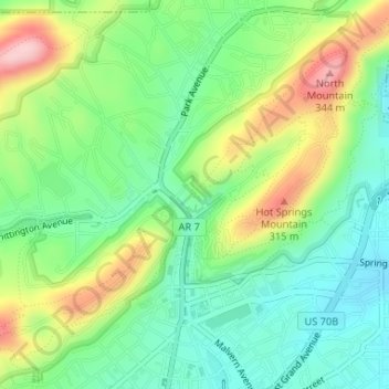
Nombre: Mapa topográfico Hot Springs National Park, altitud, relieve.
Altitud media: 227 m
Altitud mínima: 158 m
Altitud máxima: 346 m
Haz una donación
Otros mapas topográficos
Haga clic en un mapa para ver su topografía, su altitud y su relieve.