
Haz una donación
Mapa topográfico El Dorado
Haga clic en el mapa para ver la altitud.
Haz una donación
Acerca de este mapa
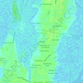
Nombre: Mapa topográfico El Dorado, altitud, relieve.
Lugar: El Dorado, Glynn County, Georgia, 31522, United States (31.15940 -81.40399 31.19940 -81.36399)
Altitud media: 4 m
Altitud mínima: -4 m
Altitud máxima: 11 m
Haz una donación
Otros mapas topográficos
Haga clic en un mapa para ver su topografía, su altitud y su relieve.
Brunswick
United States > Georgia > Glynn County
The city is the lowest in the U.S. state of Georgia, with an elevation of only 10 to 14 feet (3.0 to 4.3 m) above sea level. According to the U.S. Census Bureau, Brunswick's land area is 32.4 square miles (83.8 km2). Its total area is 42.4 square miles (109.8 km2); 10.0 square miles (26.0 km2) of this is water.
Altitud media: 2 m
Haz una donación