

Mapa topográfico Raigad Fort
Haga clic en el mapa para ver la altitud.
Raigad Fort
Located at an elevation of 820 metres (2,700 ft)above sea level in the Sahyadri mountain range, the fort offers panoramic views of the surrounding region. The fort was home to around 1,550 residents, with an average family size of five. Access to the fort requires ascending approximately 1,737 steps. Alternatively, visitors can use the Raigad Ropeway, an aerial tramway spanning 750 m (2,460 ft) in length and reaching a height of 400 m (1,300 ft), which transports passengers to the fort in approximately four minutes.
Acerca de este mapa
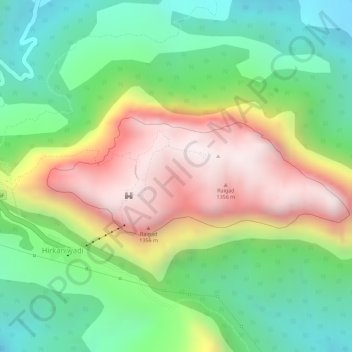
Nombre: Mapa topográfico Raigad Fort, altitud, relieve.
Altitud media: 448 m
Altitud mínima: 119 m
Altitud máxima: 866 m