
Mapa topográfico Zion National Park
Mapa interactivo
Haga clic en el mapa para ver la altitud.
Acerca de este mapa
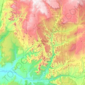
Nombre: Mapa topográfico Zion National Park, altitud, relieve.
Lugar: Zion National Park, Washington County, Utah, United States (37.14135 -113.22829 37.50429 -112.86315)
Altitud media: 1.877 m
Altitud mínima: 1.055 m
Altitud máxima: 2.876 m
The 8,726-foot (2,660 m) summit of Horse Ranch Mountain is the highest point in the park; the lowest point is the 3,666-foot (1,117 m) elevation of Coal Pits Wash, creating a relief of about 5,100 feet (1,600 m).