
Haz una donación
Mapa topográfico Read Lake
Haga clic en el mapa para ver la altitud.
Haz una donación
Acerca de este mapa
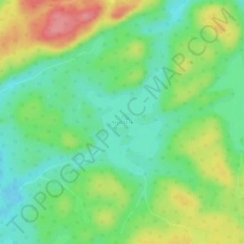
Nombre: Mapa topográfico Read Lake, altitud, relieve.
Altitud media: 382 m
Altitud mínima: 347 m
Altitud máxima: 439 m
Haz una donación
Otros mapas topográficos
Haga clic en un mapa para ver su topografía, su altitud y su relieve.
McClean Lake
Canada > Saskatchewan > Division No. 18 > Unorganized Division No. 18
Altitud media: 440 m
Clearwater River
Canada > Saskatchewan > Division No. 18 > Unorganized Division No. 18
From Broach Lake at an elevation of 460 metres (1,510 ft) above sea level, the Clearwater drops about 150 metres (490 ft) to the confluence at Fort McMurray. Its waters eventually reach the Arctic Ocean via the Athabasca and Mackenzie Rivers. Tributaries of the Clearwater River include Descharme River and…
Altitud media: 450 m
Sipanok Channel
Canada > Saskatchewan > Division No. 18 > Unorganized Division No. 18
Altitud media: 277 m