
Mapa topográfico Brewster Hill
Mapa interactivo
Haga clic en el mapa para ver la altitud.
Acerca de este mapa
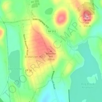
Nombre: Mapa topográfico Brewster Hill, altitud, relieve.
Altitud media: 154 m
Altitud mínima: 109 m
Altitud máxima: 225 m
Otros mapas topográficos
Haga clic en un mapa para ver su topografía, su altitud y su relieve.
Town of Putnam Valley
United States > New York > Putnam County
Town of Putnam Valley, Putnam County, New York, United States
Altitud media: 194 m
Kent Hills
United States > New York > Putnam County
Kent Hills, Town of Kent, Putnam County, New York, 10512, United States
Altitud media: 250 m
Ludingtonville
United States > New York > Putnam County > Kent Hills
Ludingtonville, Kent Hills, Town of Kent, Putnam County, New York, 10512, United States
Altitud media: 258 m