
Mapa topográfico Arambagh
Mapa interactivo
Haga clic en el mapa para ver la altitud.
Acerca de este mapa
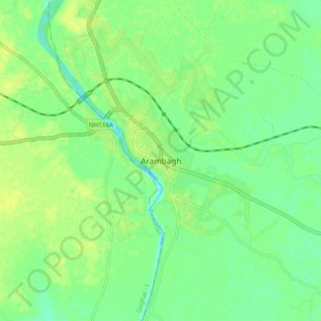
Nombre: Mapa topográfico Arambagh, altitud, relieve.
Lugar: Arambagh, Arambag, Hugli, West Bengal, 712600, India (22.83645 87.75096 22.91645 87.83096)
Altitud media: 17 m
Altitud mínima: 8 m
Altitud máxima: 25 m
Arambagh is located at 22°53′N 87°47′E / 22.88°N 87.78°E / 22.88; 87.78. It has an average elevation of 15 metres (118 feet). The town is situated on the link Road (state highway-2) 81 km north-west of Kolkata. It is located on the bank of the Dwarakeswar River.