
Mapa topográfico Rochusberg
Mapa interactivo
Haga clic en el mapa para ver la altitud.
Acerca de este mapa
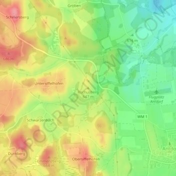
Nombre: Mapa topográfico Rochusberg, altitud, relieve.
Altitud media: 633 m
Altitud mínima: 587 m
Altitud máxima: 681 m
Otros mapas topográficos
Haga clic en un mapa para ver su topografía, su altitud y su relieve.
Obersiffelhofen
Deutschland > Bayern > Antdorf > Obersiffelhofen
Obersiffelhofen, Antdorf, Habach (VGem), Landkreis Weilheim-Schongau, Bayern, Deutschland
Altitud media: 642 m