Geolocalizar

Mapa topográfico Middlechurch

Haga clic en el mapa para ver la altitud.

Acerca de este mapa

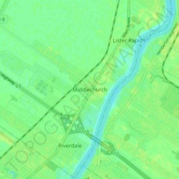
Nombre: Mapa topográfico Middlechurch, altitud, relieve.

Lugar: Middlechurch, Rural Municipality of West St. Paul, Manitoba, R4A 5A3, Canada (49.95977 -97.08780 49.99977 -97.04780)

Altitud media: 231 m

Altitud mínima: 224 m

Altitud máxima: 236 m

Otros mapas topográficos

Haga clic en un mapa para ver su topografía, su altitud y su relieve.

Winnipeg

Canada > Manitoba

Winnipeg lies at the bottom of the Red River Valley, a flood plain with an extremely flat topography. It is on the eastern edge of the Canadian Prairies in Western Canada and is known as the "Gateway to the West". Winnipeg is bordered by tallgrass prairie to the west and south and the aspen parkland to the…

Altitud media: 236 m

Assiniboine River

Canada > Manitoba

Altitud media: 481 m

Lake Manitoba

Canada > Manitoba

Altitud media: 298 m

Lake Winnipeg

Canada > Manitoba

Altitud media: 275 m

Neepawa

Canada > Manitoba

Altitud media: 370 m

Winnipeg River

Canada > Manitoba

Altitud media: 309 m

St. François Xavier

Canada > Manitoba

Altitud media: 243 m

Brandon

Canada > Manitoba > Brandon

Altitud media: 393 m

Riding Mountain National Park

Canada > Manitoba > Dauphin

The climate in the Riding Mountain region is similar to that of other regions of southwestern Manitoba. Under the Köppen classification it has a continental climate. It includes grasslands, upland boreal and eastern deciduous forest ecosystems. The park has hot summers and cold winters, with annual rainfall…

Altitud media: 488 m

Turtle Mountain Provincial Park

Canada > Manitoba > Municipality of Boissevain – Morton

Turtle Mountain Provincial Park is situated on the Turtle Mountain (plateau), one of a number of significant geographic features located along the Manitoba Escarpment, the Canadian portion of the Pembina Escarpment. It is located in the Southwest Manitoba Uplands Ecoregion, within the Canadian Prairies. The…

Altitud media: 662 m

Hayes River

Canada > Manitoba

Altitud media: 163 m

Lake of the Prairies

Canada > Manitoba

Altitud media: 502 m

Riding Mountain National Park

Canada > Manitoba > Municipality of Harrison Park > Wasagaming

Riding Mountain Biosphere Reserve covers 15,000 square kilometers of land in South-western Manitoba, with the core area, Riding Mountain National Park (RMNP), covering nearly 3,000 square kilometers. It is some 300 km northwest of Winnipeg, Manitoba. The local climate is cool and moist due to a higher…

Altitud media: 623 m

Morden

Canada > Manitoba

Altitud media: 308 m

Valley River

Canada > Manitoba

Altitud media: 496 m

Lynn Lake

Canada > Manitoba

Altitud media: 353 m

Flin Flon

Canada > Manitoba

Altitud media: 323 m

Leaf Rapids

Canada > Manitoba

Altitud media: 291 m

Carberry

Canada > Manitoba

Altitud media: 385 m

Melita

Canada > Manitoba

Altitud media: 440 m

Municipality of Lorne

Canada > Manitoba

Altitud media: 440 m

Churchill

Canada > Manitoba

Altitud media: 5 m

Athapapuskow Lake

Canada > Manitoba

Altitud media: 306 m

Grandview Municipality

Canada > Manitoba

Altitud media: 514 m

Powerview-Pine Falls

Canada > Manitoba

Altitud media: 227 m

Stonewall

Canada > Manitoba

When the last ice age retreated, as well as the prairies, escarpments such as Riding Mountain were left behind. In addition to these, smaller elevations were left behind such as Stony Mountain and Stonewall. It is believed that these escarpments were used as look-outs by early hunters approximately 4,000 to…

Altitud media: 251 m

Brandon

Canada > Manitoba

Altitud media: 394 m

Pelican Lake

Canada > Manitoba > Municipality of Killarney-Turtle Mountain

The lake is normally maintained at elevations between 411.5 and 412 metres (1,350 and 1,352 ft) above sea level during summer months. During the spring period, the lake may be raised temporarily to an elevation of 412.2 metres (1,352 ft). When the lake is low, water may be diverted from the Pembina River into…

Altitud media: 459 m

Louise Lake

Canada > Manitoba > Lynn Lake

Altitud media: 382 m

Municipality of Roblin

Canada > Manitoba

Altitud media: 594 m

Edgewood Park

Canada > Manitoba > Winnipeg

Altitud media: 234 m

Municipality of Louise

Canada > Manitoba

Altitud media: 462 m

Bison Run

Canada > Manitoba > Winnipeg

Altitud media: 234 m

Winnipeg

Canada > Manitoba

Winnipeg lies at the bottom of the Red River Valley, a flood plain with an extremely flat topography. It is on the eastern edge of the Canadian Prairies in Western Canada and is known as the "Gateway to the West". Winnipeg is bordered by tallgrass prairie to the west and south and the aspen parkland to the…

Altitud media: 236 m

Maple Grove Park

Canada > Manitoba > Winnipeg

Altitud media: 233 m

Municipality of Lorne

Canada > Manitoba

Altitud media: 440 m

Toilers Memorial Park

Canada > Manitoba > Winnipeg

Altitud media: 234 m

Beaumont

Canada > Manitoba > Winnipeg

Altitud media: 234 m

Altona

Canada > Manitoba

Altitud media: 248 m

Winnipeg

Canada > Manitoba

Winnipeg lies at the bottom of the Red River Valley, a flood plain with an extremely flat topography. It is on the eastern edge of the Canadian Prairies in Western Canada and is known as the "Gateway to the West". Winnipeg is bordered by tallgrass prairie to the west and south and the aspen parkland to the…

Altitud media: 236 m

Swan River

Canada > Manitoba

Altitud media: 338 m

Selkirk

Canada > Manitoba

Altitud media: 227 m

Flin Flon

Canada > Manitoba

Altitud media: 322 m

Swan Lake

Canada > Manitoba > Unorganized Division No. 19

The Swan Lake drainage basin covers 3,880 square miles (10,000 km2) and extends into the province of Saskatchewan. It is located between the Duck Mountains and the Porcupine Hills. Two major rivers discharge into Swan Lake from the basin, the Swan River and the Woody River. Other topographic features include…

Altitud media: 269 m