
Mapa topográfico Ilam
Mapa interactivo
Haga clic en el mapa para ver la altitud.
Ilam
The word ‘Ilam’ comprises two words-‘I’ and ‘Lam’. In Limbu language, the word ‘I’ means ‘winding’ and ‘lam’ denotes the way. The topography of this Ilam aptly depicts several winding paths crisscrossing.
Acerca de este mapa
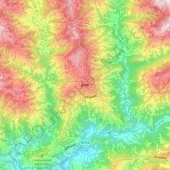
Nombre: Mapa topográfico Ilam, altitud, relieve.
Lugar: Ilam, Illam, Ilam, Koshi Province, 57300, Nepal (26.87039 87.88819 26.95039 87.96819)
Altitud media: 919 m
Altitud mínima: 419 m
Altitud máxima: 1.522 m