Mapa topográfico Κ. Αυλακίου
Mapa interactivo
Haga clic en el mapa para ver la altitud.
Acerca de este mapa
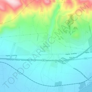
Nombre: Mapa topográfico Κ. Αυλακίου, altitud, relieve.
Altitud media: 88 m
Altitud mínima: -4 m
Altitud máxima: 365 m

Haga clic en el mapa para ver la altitud.
Nombre: Mapa topográfico Κ. Αυλακίου, altitud, relieve.
Altitud media: 88 m
Altitud mínima: -4 m
Altitud máxima: 365 m