
Mapa topográfico Cornell
Mapa interactivo
Haga clic en el mapa para ver la altitud.
Acerca de este mapa
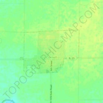
Nombre: Mapa topográfico Cornell, altitud, relieve.
Altitud media: 193 m
Altitud mínima: 183 m
Altitud máxima: 199 m
Otros mapas topográficos
Haga clic en un mapa para ver su topografía, su altitud y su relieve.
Pontiac
United States > Illinois > Livingston County
Pontiac, Pontiac Township, Livingston County, Illinois, 61764, United States
Altitud media: 199 m
Cornell
United States > Illinois > Livingston County > Cornell
Cornell, Amity Township, Livingston County, Illinois, 61319, United States
Altitud media: 192 m
Campus
United States > Illinois > Livingston County > Campus
Campus, Livingston County, Illinois, 60920, United States
Altitud media: 200 m
Odell
United States > Illinois > Livingston County
Odell, Livingston County, Illinois, 60460, United States
Altitud media: 218 m