
Mapa topográfico Yellapur
Mapa interactivo
Haga clic en el mapa para ver la altitud.
Acerca de este mapa
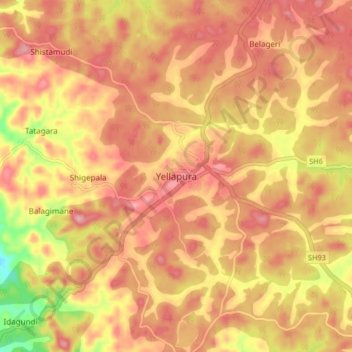
Nombre: Mapa topográfico Yellapur, altitud, relieve.
Altitud media: 529 m
Altitud mínima: 437 m
Altitud máxima: 576 m
Yellapur is located in the Western Ghats section of Karnataka. Yellapur is located at 14°58′N 74°43′E / 14.97°N 74.72°E / 14.97; 74.72. It has an average elevation of 541 metres (1774 feet). Yellapur has two famous natural falls, and many other hills and valleys.