
Mapa topográfico Pooley Country Park
Mapa interactivo
Haga clic en el mapa para ver la altitud.
Acerca de este mapa
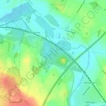
Nombre: Mapa topográfico Pooley Country Park, altitud, relieve.
Altitud media: 76 m
Altitud mínima: 57 m
Altitud máxima: 114 m
Otros mapas topográficos
Haga clic en un mapa para ver su topografía, su altitud y su relieve.
Birchmoor
United Kingdom > England > Warwickshire > North Warwickshire > Polesworth
Birchmoor, Polesworth CP, Polesworth, North Warwickshire, Warwickshire, England, B78 1AF, United Kingdom
Altitud media: 93 m