
Mapa topográfico San Juan Bautista
Mapa interactivo
Haga clic en el mapa para ver la altitud.
San Juan Bautista
In June 1904, early aviation pioneer John J. Montgomery made a series of successful test flights using his tandem-wing glider in San Juan. This was a prototype to his 1905 gliders that were used to make the first successful high-altitude flights in heavier-than-air flying machines in the world.
Acerca de este mapa
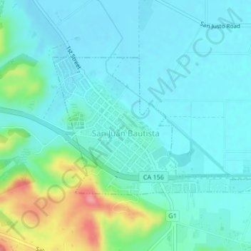
Nombre: Mapa topográfico San Juan Bautista, altitud, relieve.
Altitud media: 72 m
Altitud mínima: 50 m
Altitud máxima: 158 m