
Mapa topográfico Mount Everest
Mapa interactivo
Haga clic en el mapa para ver la altitud.
Acerca de este mapa
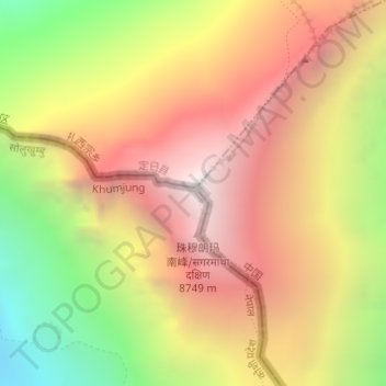
Nombre: Mapa topográfico Mount Everest, altitud, relieve.
Altitud media: 7.841 m
Altitud mínima: 6.586 m
Altitud máxima: 8.849 m
The current official elevation of 8,848 m (29,029 ft), recognised by China and Nepal, was established by a 1955 Indian survey and subsequently confirmed by a Chinese survey in 1975.
Otros mapas topográficos
Haga clic en un mapa para ver su topografía, su altitud y su relieve.
Island Peak
Nepal > Eastern Development Region > Khumjung
Island Peak, Khumjung, Solukhumbu, Sagarmatha, Eastern Development Region, Nepal
Altitud media: 5.461 m
Lhotse Shar
Nepal > Eastern Development Region > Khumjung
Lhotse Shar, Khumjung, Solukhumbu, Sagarmatha, Eastern Development Region, Nepal
Altitud media: 7.153 m