
Mapa topográfico Bloemhof
Mapa interactivo
Haga clic en el mapa para ver la altitud.
Acerca de este mapa
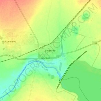
Nombre: Mapa topográfico Bloemhof, altitud, relieve.
Altitud media: 1.234 m
Altitud mínima: 1.211 m
Altitud máxima: 1.258 m
Otros mapas topográficos
Haga clic en un mapa para ver su topografía, su altitud y su relieve.
Christiana
South Africa > North West > Dr Ruth Segomotsi Mompati District Municipality > Lekwa-Teemane Local Municipality
Christiana, Lekwa-Teemane Local Municipality, Dr Ruth Segomotsi Mompati District Municipality, North West, 2680, South Africa
Altitud media: 1.211 m