
Mapa topográfico Mastuj Tehsil
Mapa interactivo
Haga clic en el mapa para ver la altitud.
Mastuj Tehsil
Mastuj (Urdu: مستوج) is a tehsil of Upper Chitral District in Khyber-Pakhtunkhwa province of Pakistan; Mastuj is the principal settlement. It is located at 36°17'0N 72°31'0E with an altitude of 2359 metres (7742 feet). There are ruins of old fort built originally in 18th century and reconstructed several times.
Acerca de este mapa
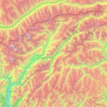
Nombre: Mapa topográfico Mastuj Tehsil, altitud, relieve.
Altitud media: 4.143 m
Altitud mínima: 1.426 m
Altitud máxima: 7.626 m