
Mapa topográfico Cumberland Gap
Mapa interactivo
Haga clic en el mapa para ver la altitud.
Cumberland Gap
The Cumberland Gap is a pass in the eastern United States through the long ridge of the Cumberland Mountains, within the Appalachian Mountains and near the tripoint of Kentucky, Virginia, and Tennessee. At an elevation of 1,631 feet (497 m) above sea level, it is famous in American colonial history for its role as a key passageway through the lower central Appalachians.
Acerca de este mapa
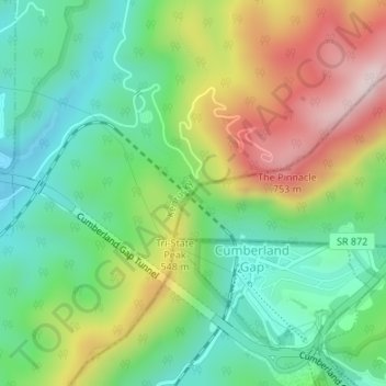
Nombre: Mapa topográfico Cumberland Gap, altitud, relieve.
Lugar: Cumberland Gap, Lee County, Virginia, 37724, United States (36.60399 -83.67369 36.60409 -83.67359)
Altitud media: 512 m
Altitud mínima: 349 m
Altitud máxima: 783 m
Otros mapas topográficos
Haga clic en un mapa para ver su topografía, su altitud y su relieve.