
Mapa topográfico Guymon
Mapa interactivo
Haga clic en el mapa para ver la altitud.
Acerca de este mapa
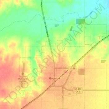
Nombre: Mapa topográfico Guymon, altitud, relieve.
Lugar: Guymon, Texas, Oklahoma, United States of America (36.66773 -101.51009 36.72926 -101.42046)
Altitud media: 933 m
Altitud mínima: 895 m
Altitud máxima: 969 m
Guymon is located at 36°40′58″N 101°28′54″W / 36.68278°N 101.48167°W / 36.68278; -101.48167 (36.6828041,-101.4815493) and sits at an elevation of 3,126 feet (953 m). According to the United States Census Bureau, the city has a total area of 7.3 square miles (18.9 km2), of which 7.3 square miles (18.9 km2) are land and 0.04 square miles (0.1 km2) (0.27%) is covered by water.