
Mapa topográfico Baie Saguenay
Mapa interactivo
Haga clic en el mapa para ver la altitud.
Acerca de este mapa
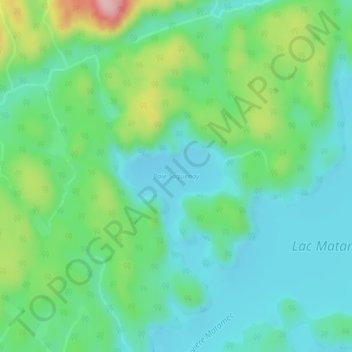
Nombre: Mapa topográfico Baie Saguenay, altitud, relieve.
Altitud media: 163 m
Altitud mínima: 115 m
Altitud máxima: 291 m
Otros mapas topográficos
Haga clic en un mapa para ver su topografía, su altitud y su relieve.
Rivière Moisie
Rivière Moisie, Sept-Îles, Sept-Rivières, Côte-Nord, Québec, Canada
Altitud media: 182 m
Lac Gamache
Lac Gamache, Route 138, Sept-Îles, Sept-Rivières, Côte-Nord, Québec, Canada
Altitud media: 116 m
Lac Labrie
Lac Labrie, Sentier motoneige Station Gallix, Sept-Îles, Sept-Rivières, Côte-Nord, Québec, Canada
Altitud media: 105 m