
Mapa topográfico Warner
Mapa interactivo
Haga clic en el mapa para ver la altitud.
Warner
Mount Kearsarge, elevation 2,937 feet (895 m) above sea level, located in the extreme north of the town, is the highest point in Warner and in Merrimack County. Two state parks are located on the mountain: Rollins State Park in Warner and Winslow State Park in Wilmot. Mount Kearsarge is a popular hiking destination, due both to its bare, rocky summit, and to the fact that a paved road climbs from Rollins State Park to within a half mile of the summit. The peak is the highest point along the 75-mile (121 km) Sunapee-Ragged-Kearsarge Greenway, a hiking trail which links ten towns and encircles the Lake Sunapee region of western New Hampshire.
Acerca de este mapa
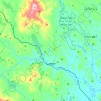
Nombre: Mapa topográfico Warner, altitud, relieve.
Lugar: Warner, Merrimack County, New Hampshire, United States (43.21310 -71.92410 43.39525 -71.72581)
Altitud media: 247 m
Altitud mínima: 103 m
Altitud máxima: 886 m